Montant total (1 article articles) :
Destination de la commande :

l'alsace: Cartes (175 résultats)
Commentaires
Passer aux résultats principaux de la recherche
Filtres de recherche
Type d'article
Particularités
Langue (6)
Livraison gratuite
- Livraison gratuite ŕ destination de Etats-Unis (Aucun autre résultat ne correspond ŕ ces critčres)
Pays
Evaluation du vendeur
-

Carte Michelin au 200 000čme N° 87 : Vosges-Alsace.
Edité par Michelin & Cie, Clermont-Ferrand, 1993
Vendeur : LIVRES ANCIENS ET CONTEMPORAINS, HASPARREN, France
Évaluation du vendeur 5 sur 5 étoiles

Carte
EUR 6
Autre deviseEUR 6 expédition depuis France vers Etats-UnisQuantité disponible : 1 disponible(s)
Ajouter au panierCouverture souple. Etat : Assez bon. GLN-712.
-
Carte Michelin au 200 000čme N° 87 : Vosges-Alsace.
Edité par Michelin, 1983
Vendeur : LIVRES ANCIENS ET CONTEMPORAINS, HASPARREN, France
Évaluation du vendeur 5 sur 5 étoiles
Carte
EUR 6
Autre deviseEUR 6 expédition depuis France vers Etats-UnisQuantité disponible : 1 disponible(s)
Ajouter au panierCouverture souple. Etat : Assez bon. DX2-C206. Livre.
-

Michelin Regional France Alsace, Lorraine Map
Vendeur : Revaluation Books, Exeter, Royaume-Uni
Évaluation du vendeur 5 sur 5 étoiles
Carte
EUR 5,06
Autre deviseEUR 11,71 expédition depuis Royaume-Uni vers Etats-UnisQuantité disponible : 1 disponible(s)
Ajouter au panierOther cartographic. Etat : Brand New. fol map bl edition. 1 pages. French language. 10.00x4.50x0.20 inches. In Stock.
-

FORET NOIRE , ALSACE 11131 CARTE ZOOM MICHELIN KAART
Vendeur : Revaluation Books, Exeter, Royaume-Uni
Évaluation du vendeur 5 sur 5 étoiles
Carte
EUR 4,17
Autre deviseEUR 11,71 expédition depuis Royaume-Uni vers Etats-UnisQuantité disponible : 1 disponible(s)
Ajouter au panierOther cartographic. Etat : Brand New. 01 edition. 1 pages. French language. 9.37x4.17x0.63 inches. In Stock.
-
Carte touristique IGN au 1:250 000 N° 1 : Lorraine-Alsace.
Edité par Institut Géographique National, 1976
Vendeur : LIVRES ANCIENS ET CONTEMPORAINS, HASPARREN, France
Évaluation du vendeur 5 sur 5 étoiles
Carte
EUR 12,50
Autre deviseEUR 6 expédition depuis France vers Etats-UnisQuantité disponible : 1 disponible(s)
Ajouter au panierCouverture souple. Etat : Assez bon. PM-GLN-711.
-

Michelin Map France: Alsace, Lorraine 516 (Maps/Regional (Michelin))
Edité par Michelin Travel & Lifestyle, 2011
ISBN 10 : 2067135244 ISBN 13 : 9782067135246
Langue: anglais
Vendeur : books4u31, Asheville, NC, Etats-Unis
Évaluation du vendeur 4 sur 5 étoiles

Carte
EUR 20,65
Autre deviseEUR 4,19 expédition vers Etats-UnisQuantité disponible : 1 disponible(s)
Ajouter au panierMap. Etat : Very Good. map and is in very good conditionAND AS ALWAYS SHIPPED IN 24 HOURS; and emailed to you a USPS tracking number on all orders; all books are sanitized and cleaned for your protection before mailing. PLEASE NOTE OVER SEAS BUYERS if the book extra large or heavy there will be additional postage due to the new US Postage rates.
-
Ancienne Carte Michelin N° 516. Alsace, Lorraine 2009. Carte au 1/200 000e.
Edité par Michelin Cartes et guides, 2014
Vendeur : Librairie Et Cćtera (et caetera) - Sophie Rosičre, Belin-Béliet, France
Évaluation du vendeur 5 sur 5 étoiles
Carte
EUR 10
Autre deviseEUR 5 expédition depuis France vers Etats-UnisQuantité disponible : 1 disponible(s)
Ajouter au panierCarte en français. Couverture orange. Une feuille 75 x 130 cm, repliée sous couverture orange. Cartes géographiques. Carte.
-

Michelin France Alsace, Lorraine (Michelin Local France Maps) (Multilingual Edition)
Edité par Michelin Travel Publications, 2005
ISBN 10 : 2067106325 ISBN 13 : 9782067106321
Langue: anglais
Vendeur : The Book Cellar, LLC, Nashua, NH, Etats-Unis
Évaluation du vendeur 4 sur 5 étoiles
Carte
EUR 33,14
Autre deviseEUR 3,52 expédition vers Etats-UnisQuantité disponible : 1 disponible(s)
Ajouter au paniermap. Etat : Very Good. Great used condition.Over 1,000,000 satisfied customers since 1997! Choose expedited shipping (if available) for much faster delivery. Delivery confirmation on all US orders.
-

Michelin. Carte au: 1.200 000 Nr. 87 Vosges - Alsace
Edité par Paris, Service de Tourisme Pneu Michelin
Langue: français
Vendeur : Antiquariat-Fischer - Preise inkl. MWST, Freiburg, Allemagne
Évaluation du vendeur 4 sur 5 étoiles
Carte
EUR 5
Autre deviseEUR 12 expédition depuis Allemagne vers Etats-UnisQuantité disponible : 1 disponible(s)
Ajouter au panierEtat : Gut. mehrfarbige Faltkarten / ca. 47 x 107 cm leichte Gebrauchsspuren 5-79 Sprache: Französisch Gewicht in Gramm: 345.
-

Western Europe Alsace Lorraine
Date d'édition : 1949
Vendeur : Antiqua Print Gallery, London, Royaume-Uni
Évaluation du vendeur 4 sur 5 étoiles
Carte
EUR 6,64
Autre deviseEUR 8,78 expédition depuis Royaume-Uni vers Etats-UnisQuantité disponible : 1 disponible(s)
Ajouter au panierEtat : Good. Alsace Lorraine. Saar Protectorate Saarprotektorat. BARTHOLOMEW 1949 old map. Vintage colour atlas map; John Bartholomew & Son (1949). 18.5 x 10.5cm, 7.25 x 4.25 inches. Condition: Good. The image shown may have been taken from a different example of this map than that which is offered for sale. The map you will receive is in good condition but there may be minor variations in the condition from that shown in the image. There are images and/or text printed on the reverse side of the picture. In some cases this may be visible on the picture itself or around the margin of the picture.
-

GUIDE DE TOURISME - ALSACE ET LORRAINE - VOSGES
Vendeur : Le-Livre, SABLONS, France
Membre d'association : ILAB
Évaluation du vendeur 5 sur 5 étoiles
Carte
EUR 16,95
Autre deviseEUR 18 expédition depuis France vers Etats-UnisQuantité disponible : 1 disponible(s)
Ajouter au panierCouverture souple. Etat : bon. RO80196961: Dépot légal 1987. In-4. Broché. Bon état, Couv. convenable, Dos satisfaisant, Intérieur frais. 205 pages augmentées de nombreuses illustrations et cartes en couleurs dans et hors texte -. . . . Classification Dewey : 912-Atlas, cartes et plans.
-

Alsace Lorraine - Michelin Regional Map 516
Edité par Michelin Editions Des Voyages Jan 2023, 2023
ISBN 10 : 2067258680 ISBN 13 : 9782067258686
Langue: anglais
Vendeur : AHA-BUCH GmbH, Einbeck, Allemagne
Évaluation du vendeur 5 sur 5 étoiles
Carte
EUR 11,26
Autre deviseEUR 28,45 expédition depuis Allemagne vers Etats-UnisQuantité disponible : 1 disponible(s)
Ajouter au panierKarte. Etat : Neu. Neuware - UPDATED ANNUALLY.
-
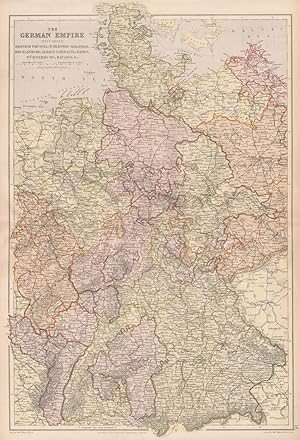
The German Empire, (West sheet), Rhenish Prussia, Schleswig - Holstein, Mecklenburg, Alsace-Lorraine, Baden, Württemberg, Bavaria, &c.
Date d'édition : 1893
Vendeur : Antiqua Print Gallery, London, Royaume-Uni
Évaluation du vendeur 4 sur 5 étoiles
Carte
EUR 10,85
Autre deviseEUR 8,78 expédition depuis Royaume-Uni vers Etats-UnisQuantité disponible : 2 disponible(s)
Ajouter au panierEtat : Good. GERMAN EMPIRE WEST. Rhenish Prussia Schleswig Alsace Bavaria. BLACKIE 1893 map. Colour Antique map; Blackie & Son (1893). 52.0 x 35.0cm, 20.5 x 13.75 inches; this is a folding map. Condition: Good. There is nothing printed on the reverse side, which is plain.
-
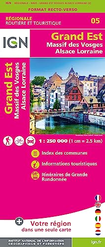
NR05 GRAND EST MASSIF DES VOSGES ALSACE LORRAINE
Vendeur : Revaluation Books, Exeter, Royaume-Uni
Évaluation du vendeur 5 sur 5 étoiles
Carte
EUR 11,02
Autre deviseEUR 11,71 expédition depuis Royaume-Uni vers Etats-UnisQuantité disponible : 1 disponible(s)
Ajouter au panierMap. Etat : Brand New. French language. 9.70x4.20x0.80 inches. In Stock.
-

IGN, CARTE TOURISTIQUE 1:250000, n°104, LORRAINE ALSACE-SARRE
Edité par Institut géographique national, 1980
Vendeur : Le-Livre, SABLONS, France
Membre d'association : ILAB
Évaluation du vendeur 5 sur 5 étoiles
Carte
EUR 16,95
Autre deviseEUR 18 expédition depuis France vers Etats-UnisQuantité disponible : 1 disponible(s)
Ajouter au panierCouverture souple. Etat : bon. RO70116809: 1980. In-12. Broché. Etat d'usage, Couv. légčrement passée, Dos satisfaisant, Intérieur frais. Carte dépliable en couleurs d'environ 88/105 cm. . . . Classification Dewey : 912-Atlas, cartes et plans.
-

LES BONNES ADRESSES DU ROUTARD - NOS MEILLEURS CAMPINGS DE FRANCE - 2007 / Alsace, Aquitaine, Auvergne, Bougogne, Bretagne, Centre, Campagne-Ardenne .
Vendeur : Le-Livre, SABLONS, France
Membre d'association : ILAB
Évaluation du vendeur 5 sur 5 étoiles
Carte
EUR 25,80
Autre deviseEUR 18 expédition depuis France vers Etats-UnisQuantité disponible : 1 disponible(s)
Ajouter au panierCouverture souple. Etat : bon. R160201625: 2007. In-8. Broché. Bon état, Coins frottés, Dos satisfaisant, Quelques rousseurs. 679 pages - Quelques rousseurs naturelles - Coins frottés et légčrement pliés - Légčres déchirures en tęte sans conséquence pour la lecture. . . . Classification Dewey : 912-Atlas, cartes et plans.
-

Vosges du Sud / Ballon d'Alsace / Le Hohneck
Edité par Institut Géographique National, 2020
ISBN 10 : 2758549743 ISBN 13 : 9782758549741
Langue: français
Vendeur : Revaluation Books, Exeter, Royaume-Uni
Évaluation du vendeur 5 sur 5 étoiles
Carte
EUR 21,88
Autre deviseEUR 11,71 expédition depuis Royaume-Uni vers Etats-UnisQuantité disponible : 1 disponible(s)
Ajouter au panierMap. Etat : Brand New. 1 pages. German language. 10.08x4.25x0.79 inches. In Stock.
-
South-West Germany including Alsace & Lorraine
Date d'édition : 1906
Vendeur : Antiqua Print Gallery, London, Royaume-Uni
Évaluation du vendeur 4 sur 5 étoiles
Carte
EUR 13,88
Autre deviseEUR 8,78 expédition depuis Royaume-Uni vers Etats-UnisQuantité disponible : 1 disponible(s)
Ajouter au panierEtat : Good. GERMANY SOUTH.Bavaria Bayen Baden Wurttemberg.Includes Alsace Lorraine 1906 map. Antique colour map; W. & A.K. Johnston, Limited Edinburgh & London (1906). 21.0 x 28.5cm, 8.25 x 11.25 inches. Condition: Good. The image shown may have been taken from a different example of this map than that which is offered for sale. The map you will receive is in good condition but there may be minor variations in the condition from that shown in the image which may include some light spotting. There are images and/or text printed on the reverse side of the picture. In some cases this may be visible on the picture itself or around the margin of the picture.
-

ATLAS AERIEN / FRANCE / TOME V / ALSACE, VOSGES, LORRAINE, ARDENNES, CHAMPAGNE, MORVAN, BOURGOGNE.
Edité par GALLIMARD, 1964
Vendeur : Le-Livre, SABLONS, France
Membre d'association : ILAB
Évaluation du vendeur 5 sur 5 étoiles
Carte
EUR 20,90
Autre deviseEUR 18 expédition depuis France vers Etats-UnisQuantité disponible : 1 disponible(s)
Ajouter au panierCouverture rigide. Etat : bon. R320009274: 1964. In-4. Cartonnage d'éditeurs. Bon état, Couv. convenable, Dos satisfaisant, Intérieur frais. 187 pages illustrées de nombreuses photos en noir et blznc - Jaquette satisfaisante et illustrée de quelques photos en couleur et noir et blanc. Avec Jaquette. . . Classification Dewey : 912-Atlas, cartes et plans.
-

CARTE ROUTIERE N°2BIS - LORRAINE ET ALSACE ( NORD)
Edité par EDITIONS TARIDE
Vendeur : Le-Livre, SABLONS, France
Membre d'association : ILAB
Évaluation du vendeur 5 sur 5 étoiles
Carte
EUR 20,90
Autre deviseEUR 18 expédition depuis France vers Etats-UnisQuantité disponible : 1 disponible(s)
Ajouter au panierCouverture souple. Etat : bon. RO70122790: Non daté. In-Plano. Broché. Etat d'usage, Couv. légčrement passée, Dos satisfaisant, Intérieur acceptable. Carte dépliante en couleurs en 16 volets en couleurs au 1/250.000e. . . . Classification Dewey : 912-Atlas, cartes et plans.
-
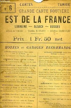
GRANDE CARTE ROUTIERE EST DE LA FRANCE, LORRAINE, ALSACE, VOSGES A L'USAGE DES CYCLISTES ET AUTOMOBILISTES N°6
Edité par EDITIONS TARIDE
Vendeur : Le-Livre, SABLONS, France
Membre d'association : ILAB
Évaluation du vendeur 5 sur 5 étoiles
Carte
EUR 20,90
Autre deviseEUR 18 expédition depuis France vers Etats-UnisQuantité disponible : 1 disponible(s)
Ajouter au panierCouverture souple. Etat : bon. RO70122529: Non daté. In-Plano. Broché. Etat d'usage, Couv. légčrement passée, Dos satisfaisant, Intérieur acceptable. Carte dépliante en couleurs en 30 volets, en couleurs au 1/250.000e dans une pochette. . . . Classification Dewey : 912-Atlas, cartes et plans.
-
Gouvernement de Lorraine et celui d'Alsace [The Provinces of Lorraine and Alsace]
Date d'édition : 1789
Vendeur : Antiqua Print Gallery, London, Royaume-Uni
Évaluation du vendeur 4 sur 5 étoiles
Carte
EUR 15,68
Autre deviseEUR 8,78 expédition depuis Royaume-Uni vers Etats-UnisQuantité disponible : 1 disponible(s)
Ajouter au panierEtat : Good. Gouvernement de Lorraine et celui d'Alsace. North-east France. BONNE 1789 map. Antique 18th century copperplate map; Rigobert Bonne (1789). 24.5 x 36.0cm, 9.75 x 14.25 inches; this is a folding map. Condition: Good. There is nothing printed on the reverse side, which is plain.
-
The German Empire (West Sheet) Rhenish Prussia, Schleswig-Holstein, Mecklenburg, Alsace- Lorraine, Baden, Würtemburg, Bavaria &c.
Date d'édition : 1882
Vendeur : Antiqua Print Gallery, London, Royaume-Uni
Évaluation du vendeur 4 sur 5 étoiles
Carte
EUR 16,88
Autre deviseEUR 8,78 expédition depuis Royaume-Uni vers Etats-UnisQuantité disponible : 2 disponible(s)
Ajouter au panierEtat : Good. GERMAN EMPIRE WEST. Inc. Alsace-Lorraine. Rhenish Prussia Bavaria &c 1882 map. Antique colour map; Engraved by Edwd. Weller, Red Lion Square; drawn by Edwd. Weller F.R.G.S (1882). 52.5 x 36.0cm, 20.75 x 14 inches; this is a folding map. Condition: Good. The image shown may have been taken from a different example of this map than that which is offered for sale. The map you will receive is in good condition but there may be minor variations in the condition from that shown in the image. There is nothing printed on the reverse side, which is plain.
-

Atlas Aérien, France. TOME 5 : Alsace, Vosges, Lorraine - Ardennes, Champagne - Morvan, Bourgogne, Jura.
Edité par GALLIMARD, 1964
Vendeur : Le-Livre, SABLONS, France
Membre d'association : ILAB
Évaluation du vendeur 5 sur 5 étoiles
Carte
EUR 25,80
Autre deviseEUR 18 expédition depuis France vers Etats-UnisQuantité disponible : 1 disponible(s)
Ajouter au panierCouverture rigide. Etat : bon. RO80121610: 30 oct. 1964. In-4. Relié. Bon état, Couv. convenable, Dos satisfaisant, Intérieur frais. 187 pages. Nombreuses photos en noir et blanc, dans le texte et hors-texte. Jaquette en état d'usage. Avec Jaquette. . . Classification Dewey : 912-Atlas, cartes et plans.
-

La Route du Jura. Du Lac Léman au Ballon d'Alsace.
Edité par P.L.M.
Vendeur : Le-Livre, SABLONS, France
Membre d'association : ILAB
Évaluation du vendeur 5 sur 5 étoiles
Carte
EUR 25,80
Autre deviseEUR 18 expédition depuis France vers Etats-UnisQuantité disponible : 1 disponible(s)
Ajouter au panierCouverture souple. Etat : bon. RO80117549: Non daté. In-8. Broché. Bon état, Couv. convenable, Dos satisfaisant, Intérieur frais. Une brochure dépliante en 6 volets, composée d'une carte en couleurs et de quelques photos en noir et blanc, au dos. . . . Classification Dewey : 912-Atlas, cartes et plans.
-

ATLAS AERIEN FRANCE tome V : Alsace Vosges Lorraine, Ardennes et Champagne, Morvan et Bourgogne, Jura.
Edité par GALLIMARD, 1964
Vendeur : Le-Livre, SABLONS, France
Membre d'association : ILAB
Évaluation du vendeur 5 sur 5 étoiles
Carte
EUR 25,80
Autre deviseEUR 18 expédition depuis France vers Etats-UnisQuantité disponible : 1 disponible(s)
Ajouter au panierCouverture rigide. Etat : bon. R240011302: 1964. In-4. Relié toilé. Bon état, Couv. convenable, Dos satisfaisant, Intérieur frais. 94 pages. Nombreuses photographies en noir et blanc dans le texte et hors texte. Avec Jaquette. . . Classification Dewey : 912-Atlas, cartes et plans.
-

The German Empire (West Sheet) Rhenish Prussia, Schleswig-Holstein, Mecklenburg, Alsace- Lorraine, Baden, Würtemburg, Bavaria &c.
Date d'édition : 1886
Vendeur : Antiqua Print Gallery, London, Royaume-Uni
Évaluation du vendeur 4 sur 5 étoiles
Carte
EUR 18,09
Autre deviseEUR 8,78 expédition depuis Royaume-Uni vers Etats-UnisQuantité disponible : 2 disponible(s)
Ajouter au panierEtat : Good. GERMAN EMPIRE WEST. Inc. Alsace-Lorraine. Rhenish Prussia Bavaria &c 1886 map. Antique colour map; Engraved by Edwd. Weller, Red Lion Square; drawn by Edwd. Weller F.R.G.S (1886). 52.5 x 36.0cm, 20.75 x 14 inches; this is a folding map. Condition: Good. There is nothing printed on the reverse side, which is plain.
-
Carte : Lorraine, Alsace, Sarre
Edité par Institut Géographique National, 1984
Vendeur : Le-Livre, SABLONS, France
Membre d'association : ILAB
Évaluation du vendeur 5 sur 5 étoiles
Carte
EUR 16,95
Autre deviseEUR 18 expédition depuis France vers Etats-UnisQuantité disponible : 1 disponible(s)
Ajouter au panierPas de couverture. Etat : bon. RO80252590: 1984. In-Plano. En feuillets. Bon état, Livré sans Couverture, Dos satisfaisant, Intérieur frais. Une carte en couleurs dépliante. 88 x 121 cm environ. Echelle : 1/250000. . . . Classification Dewey : 912-Atlas, cartes et plans.
-
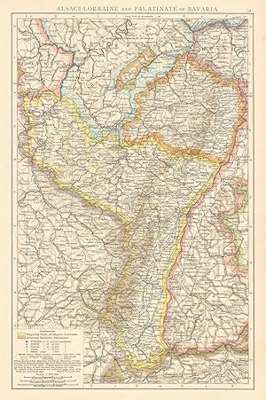
Alsace-Lorraine and Palatinate of Bavaria Alsace-Lorraine and Palatinate of Bavaria
Date d'édition : 1895
Vendeur : Antiqua Print Gallery, London, Royaume-Uni
Évaluation du vendeur 4 sur 5 étoiles
Carte
EUR 19,30
Autre deviseEUR 8,78 expédition depuis Royaume-Uni vers Etats-UnisQuantité disponible : 4 disponible(s)
Ajouter au panierEtat : Good. Rhine valley. Alsace-Lorraine & Palatinate of Bavaria. Rhineland. TIMES 1895 map. Antique colour atlas map; The Times (1895). 39.5 x 26.0cm, 15.5 x 10.25 inches. Condition: Good. There is nothing printed on the reverse side, which is plain.
-
Alsace
Date d'édition : 1957
Vendeur : Antiqua Print Gallery, London, Royaume-Uni
Évaluation du vendeur 4 sur 5 étoiles
Carte
EUR 20,50
Autre deviseEUR 8,78 expédition depuis Royaume-Uni vers Etats-UnisQuantité disponible : 4 disponible(s)
Ajouter au panierEtat : Good. Alsace wine map. Carte vinicole. Haut Rhin. Bas Rhin 1957 old vintage. Vintage colour map; Unsigned (1957). 25.0 x 17.5cm, 9.75 x 6.75 inches. Condition: Good. There is another map printed on the reverse side.


![Image du vendeur pour Gouvernement de Lorraine et celui d'Alsace [The Provinces of Lorraine and Alsace] mis en vente par Antiqua Print Gallery](https://pictures.abebooks.com/inventory/md/md31106560799.jpg)